
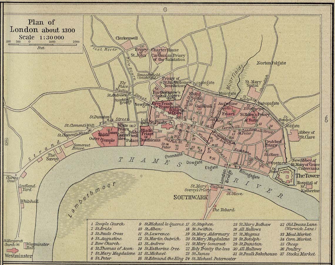
St. Olave Hart Street Church on London map c. 1300
Dublin Core
Title
St. Olave Hart Street Church on London map c. 1300
Subject
St. Olave Hart Street Church
Description
St. Olave Hart Street is located on the corner of Hart Street and Seething Lane (in close proximity to the Tower of London on the map). It is the Ward Church of the Tower Ward in the City of London. It was an eastern suburb of London in the middle ages, but is now a part of central London.
Creator
Google Maps/Google Earth,
Edits by Tara Cangialosi
Edits by Tara Cangialosi
Source
1300 Map
Map originally published in William R. Shepherd, Historical Atlas (New York: Henry Holt, 1911; rev. 1926); digitized by the Perry-Castañeda Library, University of Texas, Austin
[http://www.lib.utexas.edu/maps/historical/shepherd/london_plan_1300.jpg]; vectrized by Grandiose for Wikimedia Commons
[http://commons.wikimedia.org/wiki/File:Map_of_London,_1300.svg]
Publisher
Date
Map c. 1300
Image Created: 2015
Image Created: 2015
Contributor
Tara Cangialosi
Rights
Google Maps Attribute Guide
[http://www.google.com/permissions/geoguidelines/attr-guide.html]
[http://www.google.com/permissions/geoguidelines/attr-guide.html]
Type
Still Image
Still Image Item Type Metadata
Original Format
Online Map
Files

Collection
Citation
Google Maps/Google Earth,
Edits by Tara Cangialosi, “St. Olave Hart Street Church on London map c. 1300,” Medieval London, accessed October 23, 2024, https://medievallondon.ace.fordham.edu/items/show/156.